Countries in Map
Navigate the world of e-commerce effortlessly! Design stunning maps featuring countries with our customizable templates, showcasing your business reach and expanding your global presence.

80 results found for "Countries in Map"
Videos
Images

All the Smart Tools You Need to Streamline Your Content Creation

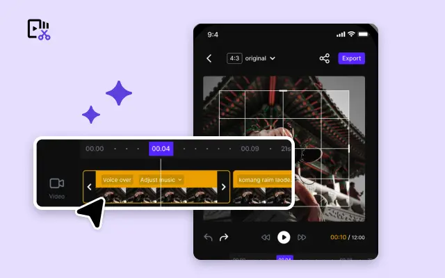
Video Editor
A powerful all-in-one video editing tool packed with features.

Sales Poster
Effortlessly create AI-powered promotional posters for your products.

Smart Crop
Crop videos to perfectly fit any platform's aspect ratio.
Custom Avatar
Create your own unique digital avatar for a personalized touch.

Image Editor
Your go-to tool for creating and editing images with ease.
Quick Cut
Speed up video editing by transcribing and editing directly from text.

Remove Background
Instantly remove backgrounds from images with one click.
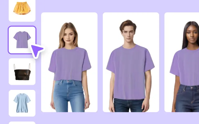
AI Model
Showcase your clothing on AI models for an immersive try-on experience.
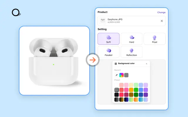
AI Shadows
Add lifelike shadows and lighting to products for enhanced realism.
About Countries in Map
Maps are a fundamental part of understanding our world, depicting the borders and landscapes of countries in a simply accessible format. However, creating a captivating map that showcases countries effectively can be challenging and time-consuming. That's where Pippit comes into play, offering specialized templates to bring your maps to life in ways you never thought possible. Whether you're a teacher looking to enhance a geography lesson, a travel blogger outlining your next adventure, or a business professional presenting data on global markets, our country map templates will serve your purpose well.
With Pippit's user-friendly platform, you can easily customize your map templates to highlight specific areas, countries, or data points that are crucial for your project. Our drag-and-drop features ensure that you can adjust the design easily; from changing colors to adding labels or icons, you have complete creative control as you craft visually stunning maps that engage your audience. Additionally, our maps are not just about visuals—they're designed with function in mind to help you optimize the delivery of your information.
Imagine presenting your next project with a beautifully designed map that clearly indicates your focus countries, supported by an engaging narrative supported by visuals. Or perhaps you want to create snapshots of different regions for a community presentation. Whatever your needs may be, our templates expedite the process, allowing you to publish your multimedia content effortlessly.
Don't let your creative vision be stuck in the world of static maps. Jumpstart your journey today with Pippit! Explore our selection of country map templates and discover the endless possibilities that await you. With just a few clicks, you’ll be ready to publish maps that speak volumes. Your next project deserves outstanding visuals; get started now and see the difference high-quality, customizable maps can make!
